The collection of maps and plans includes maps of countries on all continents, including the Russian Empire and the USSR, as well as plans of Russian and foreign cities and fortresses, published from the 17th to the 20th centuries. It comprises 4,000 items. The most comprehensive collection includes maps of the Russian Empire, its provinces, and plans of Russian cities (Moscow, Pskov, Novgorod,
... ↓
and others), as well as provincial and district capitals. The collection also includes plans of European cities and resorts (especially French and German), as well as maps of European countries. ↑

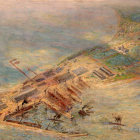 Architectural drawings of the XVIII-XX centuries 19The collection of architectural drawings from the 17th to 20th centuries comprises 14,000 museum items. Among them are architectural drawings by renowned architects such as A.V.Belogrud, A.I.Dmitriev, A.I.Krakau, L.A.Ilyin, F.I.Eppinger, and others. The collection reflects the historical aspects of global urban development from ancient times to the mid-20th century. It includes theoretical works ... ↓
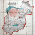 Collection of maps and plans of European and Russian cities in XVIII-XX centuries 22The collection of maps and plans includes maps of countries on all continents, including the Russian Empire and the USSR, as well as plans of Russian and foreign cities and fortresses, published from the 17th to the 20th centuries. It comprises 4,000 items. The most comprehensive collection includes maps of the Russian Empire, its provinces, and plans of Russian cities (Moscow, Pskov, Novgorod, ... ↓